Dive Brief:
-
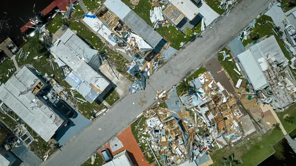
Researchers at Texas A&M University have developed a tool that may be able to produce “near-instantaneous” damage assessments and recovery forecasts following a tornado.
-
Using remote sensing from high-resolution satellite or aerial images, deep learning technology and computational models that predict how an ecosystem will respond to restoration, the model can provide a macro-scale view of damage in areas hit by tornadoes within hours, according to a TAMU press release.
-
The model can be embedded into cities’ emergency response operations and long-term recovery planning so city officials can quickly identify the hardest-hit areas, prioritize emergency services and deploy resources where they’re needed most, one of the researchers said in an email.
Dive Insight:
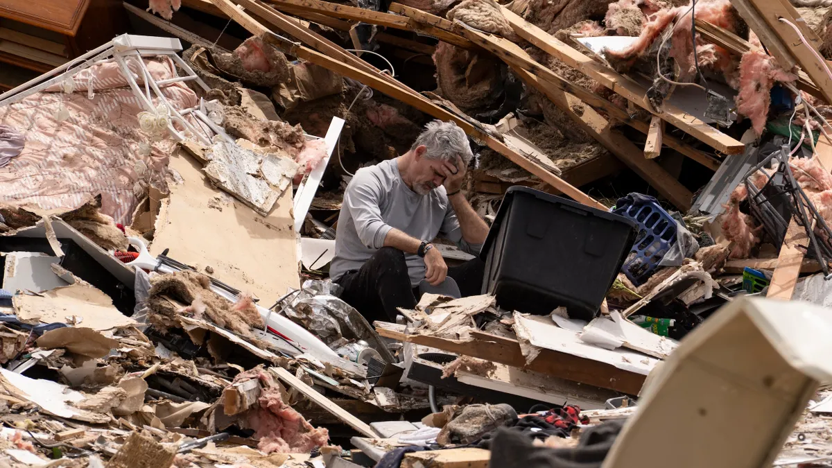
Following a tornado, a National Weather Service team is typically sent to the site to do a full ground survey to assess damage. “Manual field inspections are labor-intensive and time-consuming, often delaying critical response efforts,” Abdullah Braik, a Texas A&M civil engineering doctoral student, said in a statement. Braik co-authored the research on the model published in Sustainable Cities and Society.
The model uses high-resolution sensing imagery and AI-generated algorithms to create damage assessments within hours, providing first responders and policymakers with “actionable intelligence,” Braik said.
Immediately following a tornado, an AI tool that has been trained using images and data from previous disasters analyzes satellite images to deliver detailed damage maps. These can help officials “anticipate which neighborhoods may face delays, due to infrastructure dependencies or social vulnerabilities, allowing targeted interventions and coordinated recovery efforts across housing, utilities and public health,” Braik said in an email.
Over time, cities can use the damage and recovery data they collect to calibrate and improve the underlying models, further refining their response strategies and strengthening recovery plans for future events. “This creates a feedback loop – turning each disaster into an opportunity to build smarter, faster and more resilient systems,” Braik said.
TAMU researchers are developing the model for use after other types of disasters such as hurricanes and earthquakes and hope to extend it beyond damage assessment to include real-time updates that track recovery over time.