Tech & Data: Page 14
-

 Getty Images
Column
Getty Images
ColumnAI and the essential role of data classification and governance
Editor's note: This article was originally published in American City & County, which has merged with Smart Cities Dive to bring you expanded coverage of city innovation and local government. For the latest in smart city news, explore Smart Cities Dive or sign up for our newsletter.In an era ...
By Dr. Alan R. Shark • March 18, 2024 -
Getty Images
Cities and counties expand skills of their technology teams to meet today’s cyber-threats
Cities and counties expand skills of their technology teams to meet today’s cyber-threats
By Michael Keating • March 14, 2024 -
 Getty Images
DoorDash adds AI to chat feature to detect harassment between workers and customers
The delivery platform is replacing an old chat monitoring tool with SafeChat+, which can detect inappropriate content without specific keyword matching.
By Aneurin Canham-Clyne • March 13, 2024 -
 Getty Images
US reviewing security of connected vehicles linked to certain countries
The proposed rulemaking aims to shield transportation from foreign national security threats connected to countries such as China, Iran, North Korea and Russia.
By David Taube • March 12, 2024 -
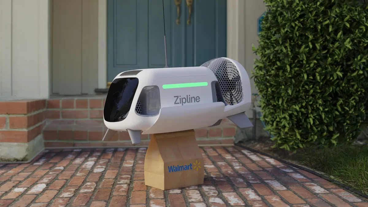 Courtesy of Walmart
Why Walmart sees drone delivery taking flight
The retailer is expanding drone delivery to up to 1.8 million additional households, linking the option to stores across more than 30 towns and municipalities in the Dallas-Forth Worth area.
By Catherine Douglas Moran • March 11, 2024 -
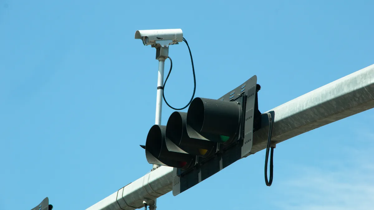 Getty Images
Automated traffic enforcement is growing. How are cities using it?
Cameras that cities use to catch drivers speeding, running red lights and blocking bus and bike lanes have “public perception and policy obstacles to overcome,” a safety official said.
By Dan Zukowski • March 11, 2024 -
Getty Images
Column
Transformation for the future: Technology is helping entities rise to the challenges of a changing world
Editor's note: This article was originally published in American City & County, which has merged with Smart Cities Dive to bring you expanded coverage of city innovation and local government. For the latest in smart city news, explore Smart Cities Dive or sign up for our newsletter.Government...
By Tammy Rimes, MPA • March 8, 2024 -
Getty Images
Column
Three tips for improving cybersecurity posture
Editor's note: This article was originally published in American City & County, which has merged with Smart Cities Dive to bring you expanded coverage of city innovation and local government. For the latest in smart city news, explore Smart Cities Dive or sign up for our newsletter.New year, ...
By Wayne Dorris • March 7, 2024 -
 Justin Sullivan via Getty Images
Robotaxi expansion approved in California over local objections
Waymo can begin operating driverless robotaxis immediately in Los Angeles and on the San Francisco peninsula following a March 1 decision by the California Public Utilities Commission.
By Dan Zukowski • March 5, 2024 -
Getty Images
Column
Unique aspects of data incident response in local government
Unique aspects of data incident response in local government
By Stephen Piepgrass, Sadia Mirza, Whitney Shephard, Gene Fishel • March 1, 2024 -
Getty Images
As they buy tech, cities want mobile systems that perform multiple tasks in all kinds of settings
Editor's note: This article was originally published in American City & County, which has merged with Smart Cities Dive to bring you expanded coverage of city innovation and local government. For the latest in smart city news, explore Smart Cities Dive or sign up for our newsletter.As they bu...
By Michael Keating • Feb. 27, 2024 -
Getty Images
Column
AI will change the affordable housing conversation for good
Editor's note: This article was originally published in American City & County, which has merged with Smart Cities Dive to bring you expanded coverage of city innovation and local government. For the latest in smart city news, explore Smart Cities Dive or sign up for our newsletter.The defini...
By Vidur Gupta • Feb. 26, 2024 -
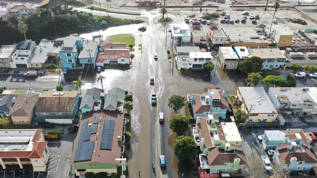 Mario Tama/Getty Images via Getty Images
Climate risk planning portal from Argonne National Lab gets new features
The portal uses one of the world's largest supercomputers to model climate change hazards. Now, communities can use it to predict impacts on vulnerable populations and infrastructure.
By Ysabelle Kempe • Feb. 26, 2024 -
 Courtesy of Waymo
Waymo updated its vehicle software after ‘rare scenario’ in Phoenix
The action comes as federal regulators increase scrutiny of AV ride-hailing companies’ safety measures following a Cruise incident last fall.
By Eric Walz • Feb. 20, 2024 -

Shutterstock / ungvar
Sponsored by RubiconSweeping changes: How Rubicon is transforming urban street operations
Efficient street sweeping is critical for maintaining cleanliness, runoff, and public safety.
By Rubicon • Feb. 20, 2024 -

Duke Givens
2023 Crown Communities Award winner: Long Beach Calif.’s GUIDES mobile app
Editor's note: This article was originally published in American City & County, which has merged with Smart Cities Dive to bring you expanded coverage of city innovation and local government. For the latest in smart city news, explore Smart Cities Dive or sign up for our newsletter. Police in...
By Michael Keating • Feb. 15, 2024 -
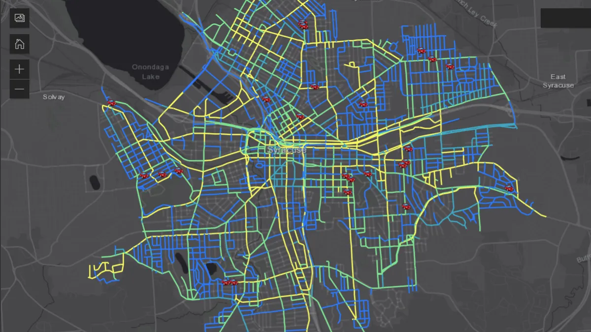 Permission granted by City of Syracuse, New York
How 3 cities are improving snow removal with software
More transparency, equity and efficiency come from systems that optimize and prioritize plows and provide real-time road data during winter storms, these cities say.
By Paige Gross • Feb. 15, 2024 -
Getty Images
Column
The chief artificial intelligence officer: A blueprint for state and local government?
Editor's note: This article was originally published in American City & County, which has merged with Smart Cities Dive to bring you expanded coverage of city innovation and local government. For the latest in smart city news, explore Smart Cities Dive or sign up for our newsletter.Late last ...
By Dr. Alan R. Shark • Feb. 13, 2024 -
 Getty Images
For faster emergency response, New York’s fire department looks to AI
The FDNY is testing an artificial intelligence-driven project to help emergency vehicles avoid traffic and other roadblocks on the way to life-threatening emergencies.
By Paige Gross • Feb. 13, 2024 -
Getty Images
Cities and counties should install technology systems that keep pace as the enterprise grows
Local governments should maintain flexibility when acquiring new technology systems, says Raffaelle Breaks, chief product officer at Unite Us, a software company that offers an integrated suite of social care solutions to governments and other organizations.
By Michael Keating • Feb. 9, 2024 -
 Permission granted by Swyft Cities
For US aerial trams, the sky’s the limit
Aerial cable cars remain rare for U.S. urban transportation, but cities and private groups see them as a novel solution to traffic woes.
By Adina Solomon • Feb. 9, 2024 -
 Getty Images
Senators introduce bill to prevent use of algorithms to raise rent
The bill follows a series of lawsuits about whether property management software has allowed property owners to indirectly coordinate rent prices.
By Mary Salmonsen • Feb. 8, 2024 -
 Courtesy of Starship
Autonomous delivery bot company raises $90M, reaches $230M in total funding
Starship Technologies will use the additional funding to expand operations, enter new markets and develop its AI technology.
By Julie Littman • Feb. 7, 2024 -
 Courtesy of New York City Department of Sanitation
New York City to pilot automated collection of large waste containers for high-density buildings
Department of Sanitation Commissioner Jessica Tisch described this as the biggest advance for local waste collection technology in decades as the city continues its push toward containerization.
By Cole Rosengren • Feb. 6, 2024 -
 Getty Images
China-linked hackers primed to attack US critical infrastructure, FBI director says
The attacks could target infrastructure such as water treatment plants, oil and natural gas pipelines, transportation systems and the electric grid, warned top cybersecurity officials.
By David Jones • Feb. 2, 2024