Public Safety: Page
-

 Getty Images
Housing, utilities and food among top US needs in 2024: United Way
People across the country “are struggling to meet their basic needs,” UWW President and CEO Angela Williams said.
By Ryan Kushner • April 2, 2025 -
Getty Images
Sponsored by
Georgia County Streamlines Access to Supplies for Public Health, Medical Examiner, Fire & EMS Teams
Success Story: Cobb County | Atlanta, Georgia
By OMNIA Partners • April 1, 2025 -
Getty Images
Sponsored by
Procurement’s Vital Role in Emergency Planning
Preparing for a disaster tomorrow begins with a plan today. Whether the emergency is as minor as water damage from a broken pipe or as significant as a large-scale disaster, procurement professionals who have a coordinated plan in place can lead the way to faster response and recovery.
By OMNIA Partners • April 1, 2025 -
Getty Images
Sponsored by
Purchasing for Severe Weather Threats to Your School or Agency
Procurement teams can take the lead on emergency preparedness and severe weather safety purchasing plans through their attention to detail and visibility into cooperative purchasing solutions. Have you analyzed and made predictions about how your supply chain would weather the storm? It’s especially critical now as organizations face higher supply chain risk due to the ongoing delays, shortages and geopolitical conflict.
By OMNIA Partners • April 1, 2025 -
Getty Images
FEMA
FEMA disaster preparedness role could decrease following Trump executive order
The order tasks local governments with playing a "more active" role in disaster preparedness.
By Ryan Kushner • March 28, 2025 -
Getty Images
Column
Designing solutions, not barriers
How cities and counties can transform mental health care through strategic civic innovation.
By Jeff Lane • March 27, 2025 -
 Dan Zukowski/Smart Cities Dive
Nearly 3,000 city leaders gathered in Washington last week. Here’s what they had to say.
Mayors, council members and nonprofit leaders heard from Vice President JD Vance, EPA Administrator Lee Zeldin and others at the National League of Cities meeting.
By Dan Zukowski • March 21, 2025 -
 Dan Zukowski/Smart Cities Dive
City leaders name housing, public safety and infrastructure as top issues
The National League of Cities Congressional City Conference brought together 3,000 city leaders to discuss these issues, with appearances from EPA Administrator Lee Zeldin and Vice President JD Vance.
By Dan Zukowski • March 18, 2025 -
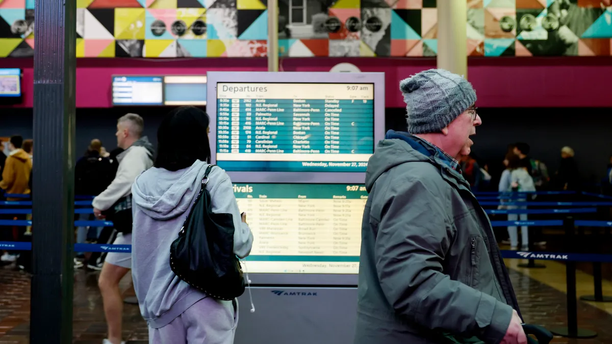 Anna Moneymaker via Getty Images
US DOT asks DC transportation authorities to focus on cutting crime
Transportation Secretary Sean Duffy directed Amtrak, the Washington Metropolitan Area Transit Authority and the District Department of Transportation to report and take action to improve safety.
By Dan Zukowski • March 7, 2025 -
Getty Images
Pilot program in Salem explores ways to mitigate rising flood risks and fill insurance gaps
The public-private pilot program is designed to explore and evaluate measures that could lower flood risks for homeowners and renters and develop a base model that could be replicated in other communities.
By Ryan Kushner • March 3, 2025 -
Getty Images
Column
Simulated wildfire evacuations could help save lives
Evacuation simulation can accurately predict how long it will take to clear neighborhoods, informing emergency managers and law enforcement how much notice is needed for safe egress.
By Bowen Kyle • Feb. 28, 2025 -
 Maddie Meyer via Getty Images
FTA postpones enforcement of state safety oversight rule for rail transit
Though the rule was effective Jan. 1, the Federal Transit Administration is postponing enforcement to March 20 in line with a Jan. 20 executive order.
By Dan Zukowski • Feb. 25, 2025 -
Getty Images
Sponsored by
Disaster Preparedness: The Three Ps for Organizational Resilience
Leveraging Cooperative Purchasing for Emergency Response and Recovery
By OMNIA Partners • Feb. 24, 2025 -
Getty Images
Local governments are acquiring more public safety technology, including transformative AI tools
Data-driven tools are revolutionizing how law enforcement agencies detect, prevent and respond to criminal activity, enabling more proactive and efficient operations.
By Michael Keating • Feb. 11, 2025 -
 Adam Gray via Getty Images
Starbucks reverses open-door policy as it pursues coffeehouse environment
Under the new policy, customers will have to make a purchase if they want to hang out in Starbucks coffee shops or use its bathrooms.
By Kristen Doerer • Jan. 15, 2025 -
Getty Images
Column
Why public safety is turning toward AI and 5G
In 2025 and beyond, it is expected that public safety professionals will prioritize both reliability and data-driven, real-time insights.
By Maggie Hallbach • Jan. 8, 2025 -
Getty Images
In 2025, public safety technology will be a spending priority for cities and counties
Priorities of cities and counties often define which public safety products and services are most in demand. Local government managers should aim to achieve quick wins as they acquire new public safety technology and services.
By Michael Keating • Jan. 2, 2025 -
Getty Images
Column
Why your municipality should take a vested interest in the background investigation process - and how tech can help
The relationship between police chiefs and municipal leaders is a key partnership—one that is essential for effective law enforcement and community safety.
By Kevin Zodrow • Dec. 24, 2024 -
Getty Images
Column
When disaster strikes: How to minimize the fiscal impact of emergency construction
As the scale and frequency of weather-related disasters continue to escalate, the financial burden on local governments is becoming increasingly severe.
By Jo Medelman • Dec. 18, 2024 -
Getty Images
As wildfire threats grow, new funding is helping local governments convert trucks into wildland fire engines
The Biden administration announced $20 million in available grants to purchase slip-on tanker units in areas with populations under 50,000.
By Ryan Kushner • Dec. 6, 2024 -
 Daphne Howland/Smart Cities Dive
Washington, DC, sues Amazon over slow Prime deliveries in underserved areas
Prime members in two zip codes aren’t receiving promised benefits, D.C.’s attorney general alleges. The e-commerce giant defended its actions by citing concerns over driver safety.
By Daphne Howland • Dec. 5, 2024 -

South Coast AQMD
Column2022 Crown Communities Award winner: Real-time air quality monitoring app from Southern California air quality management district
For its benefit to the local community, inclusivity and the district’s outside-the-box thinking, AQMD’s Mobile App is a recipient of this year’s American City and County Crown Community Award.
By Andy Castillo • Nov. 26, 2024 -
 Getty Images
Opinion
Getty Images
OpinionLoosening alcohol laws to revitalize your city’s economy is a mistake
Cities must keep our public spaces alcohol-free to preserve health and safety, warns a policy consultant at the Institute for Public Strategies, a public health organization.
By Daniel Skiles • Nov. 22, 2024 -
Getty Images
Column
Harnessing data for safer communities
When ranking the most significant developments of the digital age, the evolution of data storage does not garner many glamour points. Yet few innovations have had such a profound impact on the ability to develop new technologies and perform tasks previously unimaginable. The ability to gather, store and analyze almost unlimited amounts of data has transformed almost every aspect of society, including law enforcement.
By Taw North • Nov. 18, 2024 -
 Permission granted by Oracle
Sponsored by Oracle
Permission granted by Oracle
Sponsored by OracleTechnologies transforming public safety
Learn how modern public safety technology solutions are helping police and law enforcement serve, protect, and engage communities.
By Shane Ruiz • Nov. 18, 2024