Tech & Data: Page 26
-

 Gustavo Caballero via Getty Images
Smart streetscapes center plans community-driven research in 3 cities
Harlem, New York; New Brunswick, New Jersey; and West Palm Beach, Florida, will become test beds for community-informed engineering research on smart cities technologies.
By Maria Rachal • Aug. 17, 2022 -
 Getty Images
Column
Getty Images
ColumnAmid digitization of public infrastructure, cybersecurity is increasingly a challenge
Editor's note: This article was originally published in American City & County, which has merged with Smart Cities Dive to bring you expanded coverage of city innovation and local government. For the latest in smart city news, explore Smart Cities Dive or sign up for our newsletter.The digiti...
By Andy Castillo • Aug. 15, 2022 -
 Getty Images
More automated bus lane enforcement cameras coming to NYC
Oakland-based startup Hayden AI announced its first contract this week with New York’s Metropolitan Transportation Authority for hundreds of bus-mounted cameras.
By Maria Rachal • Aug. 12, 2022 -
Getty Images
Column
In Nevada county, data underpins efforts to address climate change
Editor's note: This article was originally published in American City & County, which has merged with Smart Cities Dive to bring you expanded coverage of city innovation and local government. For the latest in smart city news, explore Smart Cities Dive or sign up for our newsletter.Across the...
By Andy Castillo • Aug. 11, 2022 -
 Getty Images
Why cities are exploring metaverse technology
Santa Monica, California, and Seoul, South Korea, are among the cities exploring how metaverse technology can improve city services or attract and boost businesses. Still, some people fear it could leave residents behind.
By Karen Kroll • Aug. 8, 2022 -
 Getty Images
Cities hope bus-mounted cameras will hold bus lane violators accountable
Baltimore, Chicago, New York and Washington, D.C., are among the cities trying this technology to identify perpetrators, but legal snags and questions about effectiveness remain.
By Charles Pekow • Aug. 5, 2022 -
 Getty Images
Opinion
Getty Images
OpinionTogether, EVs, AVs and multimodal transportation will create more vibrant cities
Gas stations, subway stations, parking garages and roads are among the city features we can reimagine as new mobility technologies change how we get from point A to point B, writes a leading exec at Gensler.
By Andy Cohen • Aug. 5, 2022 -
 Permission granted by BIG and Bucharest Studio
For his new smart desert city, billionaire Marc Lore eyes Nevada, Utah and Arizona
During a town hall in New York City, the Diapers.com founder and his team envisioned Telosa having dozens of “15-minute cities” and a resident-controlled endowment to help pay for government services.
By Adina Solomon • July 29, 2022 -
 Permission granted by Bond
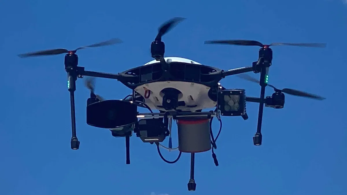
Coral Gables, Florida, deploys drones designed to respond to emergencies sooner than police
Bond's Air Guardian surveils for threats during large events, identifies suspects during ongoing criminal activity and assesses fires or natural disasters before first responders can arrive.
By Danielle McLean • July 26, 2022 -
 Getty Images
Pop-up bike lanes assessed with high-tech and low-tech strategies in New Jersey
Virtual reality-capture technology, traffic cameras and lidar footage — plus chalk, stencils, and a pool noodle — helped Rutgers University researchers evaluate temporary bike lanes in Asbury Park, New Jersey.
By Charles Pekow • July 25, 2022 -
 Getty Images
Miami Beach pilot aims to address loud cars with noise-detecting cameras
Following implementation in Knoxville, Tennessee, and New York City, the Florida city is looking to use technology to help crack down on noise violations from vehicles.
By Danielle McLean • July 22, 2022 -
 Permission granted by Amazon
Amazon expanding drone delivery service to Texas
The mayor of College Station said in a statement that being an early adopter of the service could put it "at the forefront of the development of drone delivery technology.”
By Max Garland • July 15, 2022 -
 Getty Images
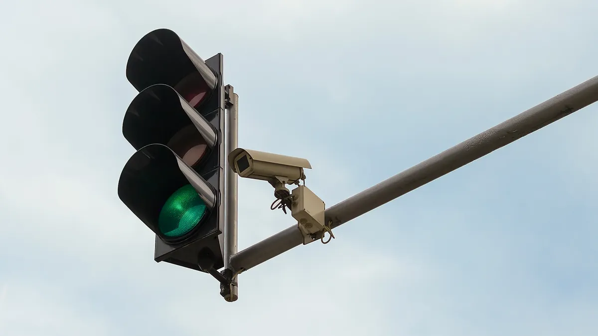
Washington, DC, among cities piloting transparency standard for digital tech
Cities implementing the Digital Trust for Places and Routines communications standard incorporate signs with visual icons and QR codes that inform the public of nearby technology like sensors and cameras.
By Austyn Gaffney • July 15, 2022 -
Getty Images
22 mayors kick off Bloomberg Philanthropies’ City Data Alliance program
22 mayors kick off Bloomberg Philanthropies’ City Data Alliance program
By Michelle Havich • July 14, 2022 -
 Getty Images
With IT modernization plan, Chicago aims for more accessible, transparent and secure data
A holistic initiative to modernize data access and IT infrastructure citywide could put Chicago at the forefront of urban tech efforts, government IT experts say.
By Austyn Gaffney • July 13, 2022 -
Getty Images
Column
Report: Local governments are satisfied with current hybrid work arrangement
As hybrid work practices enacted during the pandemic as emergency measures continue to solidify in the post-pandemic workforce, the public sector is embracing a changing digital landscape.
By Andy Castillo • July 11, 2022 -
 Courtesy of Argo AI
Ford, VW-backed AV technology firm Argo AI lays off 150 workers
As self-driving AV technology comes under increased criticism, the company that began operations in Austin and Miami this spring says it is making "adjustments to our business plan."
By Dan Zukowski • July 8, 2022 -
 Permission granted by Leica Geosystems
High-speed reality capture tool holds sustainability, preservation potential for cities
Using quick scanning technology, the latest generation of Leica Geosystems’ BLK360 device can help cities create digital twins that can be used in sustainability initiatives and for maintaining existing infrastructure.
By Melissa Goldin • June 29, 2022 -
Getty Images
Column
Amid tech labor shortage, outsourcing digital services could provide relief
Editor's note: This article was originally published in American City & County, which has merged with Smart Cities Dive to bring you expanded coverage of city innovation and local government. For the latest in smart city news, explore Smart Cities Dive or sign up for our newsletter.The COVID-...
By Andy Castillo • June 21, 2022 -
Getty Images
Column
Buying smart solutions: Technology is now part of (almost) every government purchase
Editor's note: This article was originally published in American City & County, which has merged with Smart Cities Dive to bring you expanded coverage of city innovation and local government. For the latest in smart city news, explore Smart Cities Dive or sign up for our newsletter.When munic...
By Tammy Rimes, MPA • June 21, 2022 -
Getty Images
Column
How coastal cities can prioritize and invest in climate resilience
Editor's note: This article was originally published in American City & County, which has merged with Smart Cities Dive to bring you expanded coverage of city innovation and local government. For the latest in smart city news, explore Smart Cities Dive or sign up for our newsletter.The city o...
By Patrick A. Duhaney • June 21, 2022 -
 Getty Images
Opinion
Getty Images
OpinionAI-enabled cameras and lidar can improve traffic today and support the AVs of tomorrow
Upgrading traffic cameras with AI improves performance and prepares for advancements such as autonomous vehicles. Future systems will likely tap the benefits of both cameras and lidar, write the co-founders of AI platform Derq.
By Georges Aoude and Karl Jeanbart • June 17, 2022 -
 Lund, Ken. (2006). "Reno Arch, Reno, Nevada" [Photograph]. Retrieved from Flickr.
Reno, Nevada, joins cities using blockchain to improve record-keeping
As the city rolls out its “Biggest Little Blockchain” initiative to create what’s described as a first-of-its-kind record-keeping system, some other local governments are using the tech for what it is at its core – a ledger.
By Melissa Goldin • June 14, 2022 -
 Justin Sullivan via Getty Images
Micromobility operators expand their footprint in small and midsized cities
As e-scooter and e-bike fleets hit the streets in dozens of smaller cities nationwide, operators try to take a localized approach to address many of the same complaints that have been voiced by residents of larger cities.
By Austyn Gaffney • June 9, 2022 -
 Getty Images
All signs point to a ‘growing appetite’ for digital twins: report
Implementation is expected to increase 36% over the next five years, according to a Capgemini Research Institute report. But one smart city expert cautions city leaders against falling for the technology's "hype.”
By Cailin Crowe • June 8, 2022